Geocoding
Advertisement
GeodesiX v.3.0
GeodesiX is an addin for Microsoft Excel which allows you to display maps, perform forward and reverse geocoding, compute distances (Great Circle, driving, bicycling and walking) and verify your results in Google Maps, all within Excel.
Advertisement
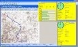
EZ-Locate Client v.2 47
EZ-Locate is an Internet-based geocoding service that provides real-time access to the Tele Atlas address database and geocoding technology.
GeoDress v.0.0.6 Alpha
GeoDress is a software for reverse geocoding of JPEG pictures. Reverse geocoding means that you have the coordinates of your pictures and want to know the addresses (like country, city, street). JPEG pictures geodecoding made easy.GeoDress Features:
Fap Tracker v.1.0.1
The Fap Tracker is a software that geocodes IP addresses that appear to come from video streams. You can even fight crime with it. IP geocoding made easy.
Pygeotag v.1.0
The suite of Python-based shell tools for geocoding images from GPS logs (GPX)
OkMap v.8.9.2
OkMap is a software that works with vectorial and raster maps that you have bought or scanned. OkMap lets you organize paths by creating waypoints, routes and tracks, and upload/download data to/from your GPS. OkMap supports GPS real-time navigation.
FreeView v.10 3
Geomatica FreeView is a flexible data viewing tool supporting over 100 raster and vector formats for loading, viewing, selection, and enhancement. FreeView is useful for any geospatial data viewing application, and is freely distributable.
GeoSetter v.3.4.22.2128
GeoSetter is a freeware tool for Windows (XP or higher) for showing and changing geo data and other metadata (IPTC/XMP/Exif) of image files (e.g. images taken by digital cameras).
Geomatica FreeView v.9. 1. 2005
Geomatica FreeView is a flexible data viewing tool supporting over 100 raster and vector formats for loading, viewing, selection, and enhancement. FreeView is useful for any geospatial data viewing application, and is freely distributable.
GeoIPTC v.1.0.1
With GeopIPTC you will be able to read the IPTC city information in pictures and get the corresponding coordinates to your photos from several free services and embed this into the pictures in standard tags in a very professional way.
ArcGIS API for Microsoft v.2 2
The API is built on the Microsoft Silverlight platform which is integrated with Visual Studio 2010 and Expression Blend 4.