Geocoding
Advertisement
FreeView v.10 3
Geomatica FreeView is a flexible data viewing tool supporting over 100 raster and vector formats for loading, viewing, selection, and enhancement. FreeView is useful for any geospatial data viewing application, and is freely distributable.
Advertisement
GeoSetter v.3.4.22.2128
GeoSetter is a freeware tool for Windows (XP or higher) for showing and changing geo data and other metadata (IPTC/XMP/Exif) of image files (e.g. images taken by digital cameras).
Geomatica FreeView v.9. 1. 2005
Geomatica FreeView is a flexible data viewing tool supporting over 100 raster and vector formats for loading, viewing, selection, and enhancement. FreeView is useful for any geospatial data viewing application, and is freely distributable.
GeoIPTC v.1.0.1
With GeopIPTC you will be able to read the IPTC city information in pictures and get the corresponding coordinates to your photos from several free services and embed this into the pictures in standard tags in a very professional way.
ERDAS ER Mapper v.7 2
ERDAS ER Mapper allows you to visualize, enhance and combine images for a broad array of applications. Extracting the quantitative information you need, ERDAS ER Mapper makes your data more meaningful to solve business problems.
CubeDynasim v.1. 4. 2017
Cube Dynasim is an extremely powerful software system allowing planners and engineers to quickly simulate, visualize, and evaluate the effects.
LayerTransparency v.1.0
When working with ArcMap, it is inevitable that you will want to look through layers and see how they overlay on top of the layers underneath.
Cube Base v.1.0
Cube Base is the powerful and comprehensive user interface for all Cube modeling modules and extensions. Cube Base is used to design and apply the models, to edit and manage all input and output data and to run and analyze scenarios.
ArcGIS API for Microsoft v.2 2
The API is built on the Microsoft Silverlight platform which is integrated with Visual Studio 2010 and Expression Blend 4.
MyExifLibrary v.1 1
MyExifLibrary is fully managed .NET Framework easy-to-use library for .NET Framework 2.0 designed for reading, editing and saving the EXIF (Exchangeable Image File Format) data embeded in images taken from digital cameras.
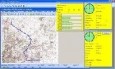
Streets On A Disk v.8 2
Streets On A Disk is full featured mapping software. Streets includes the ability to overlay database or other custom information on the map, a professional map editor, and full search capabilities.